services
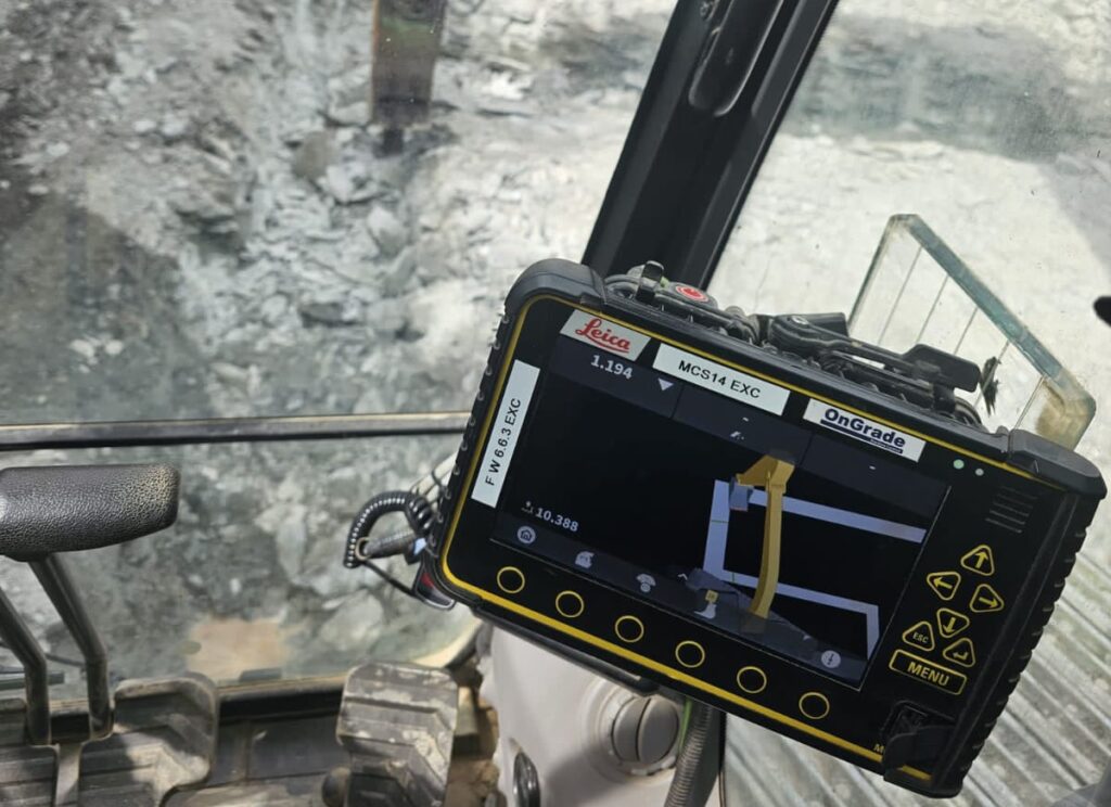
Machine Control Models (DTMs)
We have years of experience preparing accurate DTM models for machine control, helping construction teams work smarter and safer. Machine control uses GNSS, total stations, and 3D models to guide plant machinery with precision—ideal for earthworks, roadworks, drainage, and more.
We create DTMs based on your plans, tailored to your equipment’s format (Trimble, Leica, Topcon, etc.). We can also liaise with your project designer to ensure the data is compatible and ready to use.
Applications include:
Bulk excavation & filling
Road & hardstanding trimming
Drainage excavation
Service avoidance (above & below ground)
services
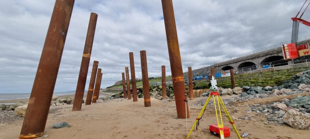
Site Setting Out
With over 60 years of combined experience, we provide accurate and reliable site setting out for projects of any size—from single house plots to major schemes like hospitals, highways, and marine structures.
Our engineers have delivered on complex projects including 8km dual carriageways and builds with over 1,400 bolt clusters. We use the latest GNSS and robotic total stations for speed, precision, and efficiency.
By working directly with your design teams, we ensure data is received and processed in the right digital format—reducing on-site calculations and minimising errors.
Let us help set out your project—accurately, efficiently, and with confidence.
services
PAS 128 Utility Surveys & GPR
We provide PAS 128-compliant utility surveys using Ground Penetrating Radar (GPR) and advanced detection tools to map underground services accurately. This reduces risk, prevents costly clashes, and keeps your project moving safely and smoothly.
Whether you’re in early design or about to dig, we deliver the insights you need to plan with confidence.
What we offer:
High-resolution detection of known & unknown utilities
On-site colour-coded service markings
Digitised, georeferenced outputs for CAD & BIM integration
Full compliance with the latest PAS 128 standards
services
Volume & Quantity Surveys
Accurate volume measurement is essential for cost control, planning, and efficient delivery. Whether it’s cut-and-fill, stockpiles, or bulk earthworks, we provide reliable data to keep your project on track.
We use advanced methods like 3D laser scanning, drone photogrammetry, GNSS, and total stations to calculate volumes with precision.
Our services include:
Cut & fill calculations
Stockpile assessments
Excavation & backfill measurement
Site regrading & earthmoving support
