Case Study
Topographical Survey – Development Site, North Wales
Overview
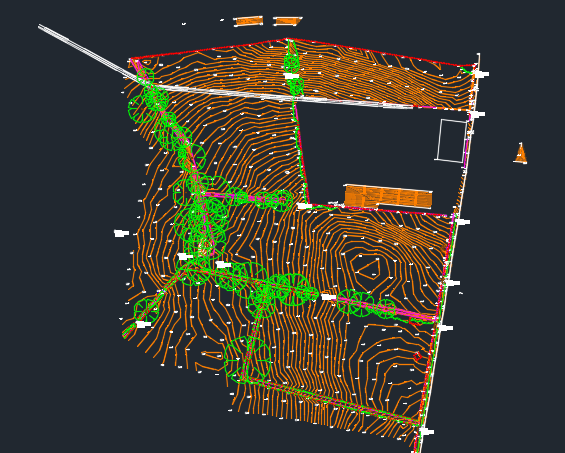
We were appointed by a property developer to complete a full topographical survey of a 40,000m² site in North Wales. The mixed-use area included open agricultural fields, industrial land, and future development zones.
Survey Scope
We recorded features such as hedgerows, scattered trees (noting trunk diameters and canopy spreads), industrial buildings, and hardstanding areas. An adjacent A-road was surveyed to inform potential access, drainage, and traffic planning.
Methodology
All visible above-ground services were levelled and mapped, including manholes, gullies, and inspection chambers. A 10m grid was applied to open areas for consistent ground modelling. Precision GPS and total stations ensured accurate data collection throughout.
Deliverables & Outcomes
We delivered CAD and PDF topographic models tailored to the client’s needs. The survey provided a vital planning tool, enabling efficient project progression and informed design decisions.
Case Study
Spillway Construction – Snowdonia national park.
Overview
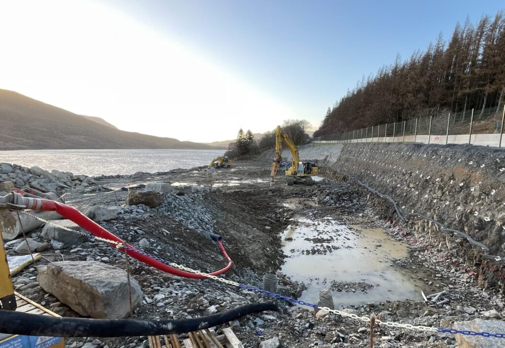
We were proud to support the construction of a major new spillway at Wales’ largest reservoir, located 300m above sea level in Snowdonia National Park. Designed to handle a 1:10,000 year storm, the project required precision and resilience in a remote, weather-exposed environment.
Surveying & Setting Out
Our responsibilities included the detailed setting out of the 200m-long spillway, which featured both open channel and covered sections. Over 10,000 cubic metres of concrete were poured, with accurate survey control critical throughout the build.
Enabling Works
Around 70,000 cubic metres of material were excavated, stockpiled, and reinstated as part of the enabling works. We also supported the safe installation and monitoring of approximately 1,000 temporary soil nails to maintain slope stability during construction.
Outcome
Despite logistical and environmental challenges, we delivered reliable survey control, responsive monitoring, and adaptable support. Our work was key to the safe, compliant, and successful delivery of this critical flood resilience infrastructure.
Case Study
Excavator Machine Control Implementation – North Wales
Overview
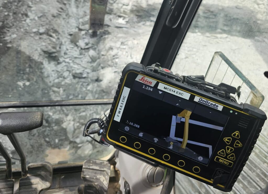
A forward-thinking groundworks contractor partnered with Gora Geomatics to introduce excavator machine control technology across multiple construction sites in North Wales. The goal was to improve efficiency, enhance accuracy, and reduce reliance on traditional surveying methods.
Our Involvement
We provided a complete support package, liaising with project designers to obtain digital data in the correct format, creating an accurate 3D digital terrain model (DTM) tailored to the site’s design, and setting up and calibrating the machine control system using GPS and local control. We also delivered on-site guidance and ongoing technical support.
Outcomes
Machine control delivered clear benefits: Improved efficiency – Faster progress with fewer stoppages. Increased speed – Quicker excavation and grading. Enhanced safety – Fewer ground personnel needed near machinery. Reduced waste – Precise digging minimised rework. Lower labour needs – Operators worked with minimal guidance.